Sea Lane Security Risk Calculator
Calculate Your Route Risk
Risk Assessment
Recommended Actions
- Consider SHADE coordination for real-time threat sharing
- Activate CISE data integration for vessel tracking
- Contact ReCAAP for regional cooperation protocols
Every day, over 90% of the world’s goods move across the ocean. That’s trillions of dollars in food, fuel, electronics, and medicine traveling along just a handful of key sea lanes. But as regional tensions rise-from the Red Sea to the South China Sea-these vital routes are becoming more dangerous, not less. Protecting them isn’t just about navies or patrols. It’s about cooperation. Real, messy, complicated, and absolutely necessary cooperation between nations, companies, and international bodies.
Why Sea Lanes Matter More Than Ever
Think about your morning coffee. Where did it come from? Probably Brazil or Colombia. How did it get to your local shop? Likely aboard a container ship that crossed the Indian Ocean, passed through the Strait of Malacca, and then sailed through the Suez Canal. That’s three critical chokepoints, all under increasing pressure. In 2025, over 100 Iran-linked vessels were sanctioned by the U.S. alone. Piracy in the Gulf of Guinea spiked 40% from 2023 to 2024. Armed attacks on ships in the Red Sea forced major shipping companies to reroute around Africa, adding 10-14 days to voyages and billions in extra costs.
These aren’t isolated incidents. They’re symptoms of a broader breakdown in trust. Countries that once worked together to fight piracy off Somalia now compete over influence in the Indo-Pacific. The U.S. and China patrol the same waters with different rules. Russia’s naval presence in the Mediterranean grows. And no one has a clear way to stop it.
The Frameworks That Keep Trade Moving
Despite the chaos, there are systems in place-quiet, technical, and surprisingly effective. One of the most important is SHADE (Shared Awareness and De-confliction), a forum created in 2009 to coordinate anti-piracy efforts off the Horn of Africa. It brought together navies from 30+ countries, commercial shipping firms, and insurance companies. No one led it. No one owned it. But everyone used it. They shared real-time reports on suspicious vessels, coordinated patrol zones, and avoided friendly fire. The result? Piracy off Somalia dropped by over 95% by 2018.
Today, similar models are being replicated. The EU’s Coordinated Maritime Presences (a flexible framework launched in 2021 to optimize naval deployments across the globe) lets member states rotate patrols in key zones without creating permanent foreign bases. In Asia, ReCAAP (Regional Cooperation Agreement on Combating Piracy and Armed Robbery against Ships in Asia) collects data on over 1,000 maritime incidents annually, from hijackings to illegal fishing. Denmark joined in 2010 and now uses its data to guide patrols in the Indian Ocean.
Then there’s the CISE (Common Information Sharing Environment for the Maritime Domain), developed by the European Maritime Safety Agency (EMSA). It’s not a military system. It’s a data hub. It pulls together satellite images, AIS signals (automatic ship tracking), port records, and weather data from 20+ EU countries. When a ship disappears from radar, CISE can cross-check its last known route with customs logs, insurance claims, and even drone footage from coastal radar stations. It doesn’t stop pirates-it helps you find them faster.
Technology Is Changing the Game
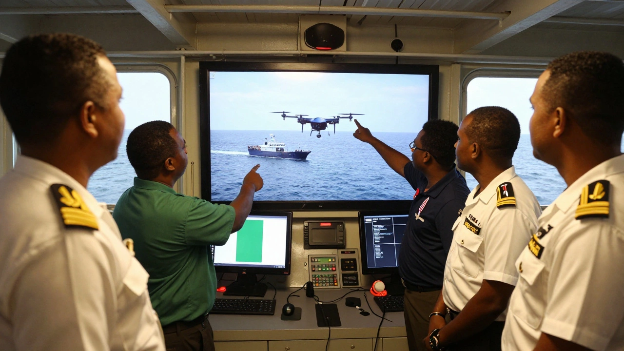
Technology isn’t just a tool-it’s becoming the glue holding maritime security together. The EMSA (European Maritime Safety Agency) now uses AI-powered satellite analysis to detect ships turning off their transponders. In 2025, over 80% of suspicious vessel behavior in the Mediterranean was flagged by machine learning models trained on decades of smuggling patterns.
Companies like Thales (a global defense and aerospace firm offering autonomous mine-hunting systems and CoastShield coastal surveillance) and Kongsberg Maritime (Norwegian firm specializing in integrated maritime command systems) are building platforms that let coast guards, navies, and even private shipping operators see the same picture. A cargo ship in the Gulf of Aden can now send a distress signal that triggers alerts to Danish, French, and U.S. naval units within seconds-all through a single interface.
And it’s not just about ships. The World High Seas Treaty (entered into force in January 2026, creating the first legally binding framework to protect oceans beyond national jurisdiction) is forcing countries to share data on deep-sea mining, illegal fishing, and undersea cable damage. For the first time, companies exploring seabed minerals must report their activities to a central UN body. This isn’t regulation for regulation’s sake. It’s about preventing chaos. If three nations start mining the same underwater ridge without coordination, it could trigger a military standoff.
Regional Cooperation Is the Real Battleground
Global frameworks mean little if they don’t work on the ground. That’s why regional partnerships are where progress is being made-and where it’s most fragile.
In Africa, the Yaoundé Architecture (a network of information-sharing centers in the Gulf of Guinea, supported by the EU and Denmark) links coast guards from Nigeria, Ghana, Cameroon, and Gabon. Before 2020, each country operated alone. Now, they share real-time intelligence. In 2024, coordinated patrols led to the arrest of 14 pirate gangs and the recovery of 18 stolen vessels.
On the other side of the world, the Djibouti Code of Conduct (a regional agreement for East Africa, backed by the EU and UN) helps Kenya, Somalia, and Seychelles train their maritime police. Denmark has sent instructors, funded patrol boats, and helped draft laws that let local courts prosecute pirates instead of letting them go free. That’s the key: enforcement. You can’t just catch pirates-you have to lock them up.
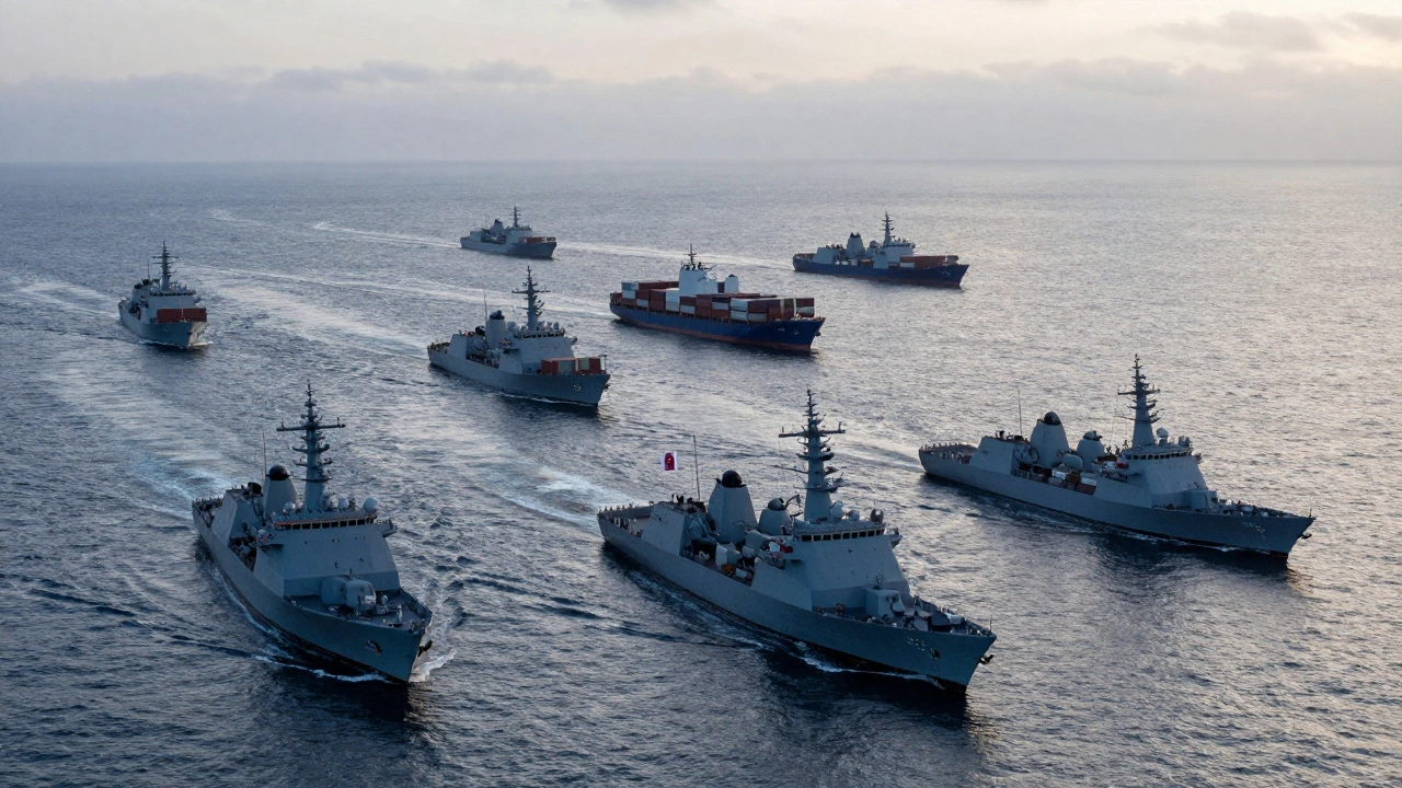
And then there’s the Red Sea. Since late 2023, Houthi attacks on commercial ships have forced rerouting, disrupted global supply chains, and pushed insurance costs up by 300%. The U.S. and UK launched airstrikes. But the real solution? A coalition of 12 nations, including India, Japan, and the UAE, now patrol the area under a shared command center. No one takes credit. No one claims ownership. But every ship that passes through now has a better chance of making it home.
The Hidden Partners: Companies and Data
Here’s the uncomfortable truth: governments can’t do this alone. Commercial companies hold more real-time data on ship movements than most navies. Satellite firms like Planet Labs and Spire track every vessel with GPS. Insurance companies know which ports are risky. Shipping giants like Maersk and MSC have their own security teams.
NATO’s Baltic Sentry (a 2025 operation detecting undersea cable threats using commercial satellite analytics) is a perfect example. Instead of launching drones, NATO bought data from a private firm that monitors seabed activity. The firm flagged unusual movements near a key fiber-optic cable. NATO sent a frigate. They found a suspicious submersible. No one knew who sent it. But they stopped it.
That’s the new model: governments provide authority. Companies provide visibility. Together, they create deterrence. And it’s working. In 2025, over 70% of maritime intelligence used by EU forces came from private sources. The line between public and private security is blurring-and that’s a good thing.
The Road Ahead
The biggest threat to maritime security isn’t pirates or missiles. It’s fragmentation. When countries stop talking, when data stays locked in national systems, when alliances fracture, the sea lanes become battlegrounds. The solution isn’t more ships. It’s more trust.
Denmark, as a UN Security Council member for 2025-2026, is pushing for three things: first, that UNCLOS-the UN Convention on the Law of the Sea-remains the only legal foundation for maritime activity. Second, that every new security initiative includes civilian oversight. Third, that technology is open, interoperable, and not controlled by one nation.
The U.S. is investing in commercial shipbuilding. The EU is expanding CISE to include Africa and Latin America. China is building port facilities from Pakistan to Greece. And all of them, whether they admit it or not, rely on the same basic truth: no country can protect its trade alone. The sea doesn’t care about borders. Neither should security.
Why can’t one country handle maritime security on its own?
No single country controls enough sea lanes to protect global trade. The Strait of Malacca, Suez Canal, and Strait of Hormuz are used by ships from over 100 nations. A U.S. Navy ship can’t patrol the entire Indian Ocean, and China’s fleet can’t cover the Gulf of Guinea. Only coordinated efforts-sharing intelligence, aligning patrols, and using common tech-can cover the scale of modern shipping.
What role does the EU play in maritime security?
The EU leads in data sharing and regional coordination. Through CISE, it integrates satellite, AIS, and port data from 27 member states. It funds patrols in Africa and Asia, trains local coast guards, and pushes for legal frameworks like the World High Seas Treaty. The EU doesn’t have a navy, but it has the most advanced maritime surveillance network in the world.
How do private companies contribute to maritime security?
Private firms own 80% of the satellite data, AIS tracking, and AI analysis used to detect suspicious ships. Companies like Thales and Kongsberg build the systems navies use. Shipping firms like Maersk share real-time vessel locations with security centers. Insurance companies fund patrols to protect their assets. In effect, the private sector is now a critical layer of maritime defense.
What’s the difference between piracy and armed robbery at sea?
Piracy happens outside national waters, typically in international seas. Armed robbery occurs inside territorial waters, often near ports. Legally, this matters because different laws apply. Piracy is governed by UNCLOS and can be prosecuted by any nation. Armed robbery falls under national jurisdiction, which is why regional cooperation-like ReCAAP or the Yaoundé Architecture-is so important: it helps countries prosecute crimes in their own waters.
Why is the World High Seas Treaty important?
It’s the first legally binding agreement to protect the ocean beyond national borders-60% of the planet’s surface. Before 2026, no one could regulate deep-sea mining, illegal fishing, or undersea cable sabotage in international waters. Now, countries must report activities, share environmental data, and create marine protected areas. It doesn’t stop conflict, but it gives everyone a common rulebook.